
About Me

I am a Geoinformatics postgraduate student based in India, with a passion for spatial data analysis and geographic information systems. Currently completing my MSc in Geoinformatics. I specialise in QGIS, remote sensing, and spatial problem solving.

Connect on LinkedIn

My Projects

From pedestrian accessibility analysis to transit visualisation, my work applies spatial data to real-world urban mobility and transport challenges, built using QGIS, OpenStreetMap, and network analysis tools.

Explore My Work
Skills

Skills & Certifications

Education
MSc in Geoinformatics (Ongoing)

Certifications
Advanced QGIS Certification

Skills
QGIS · Network Analysis · OpenStreetMap · Remote Sensing · Spatial Data Analysis · FFmpeg · Geospatial Visualisation

View My CV

Projects

A collection of spatial analysis and GIS projects exploring urban mobility, transport networks, and accessibility - developed using QGIS, OpenStreetMap data, and geospatial analysis techniques.

Urban Heat Island Analysis Prayagraj

Urban Heat Island Analysis
Prayagraj, 2026

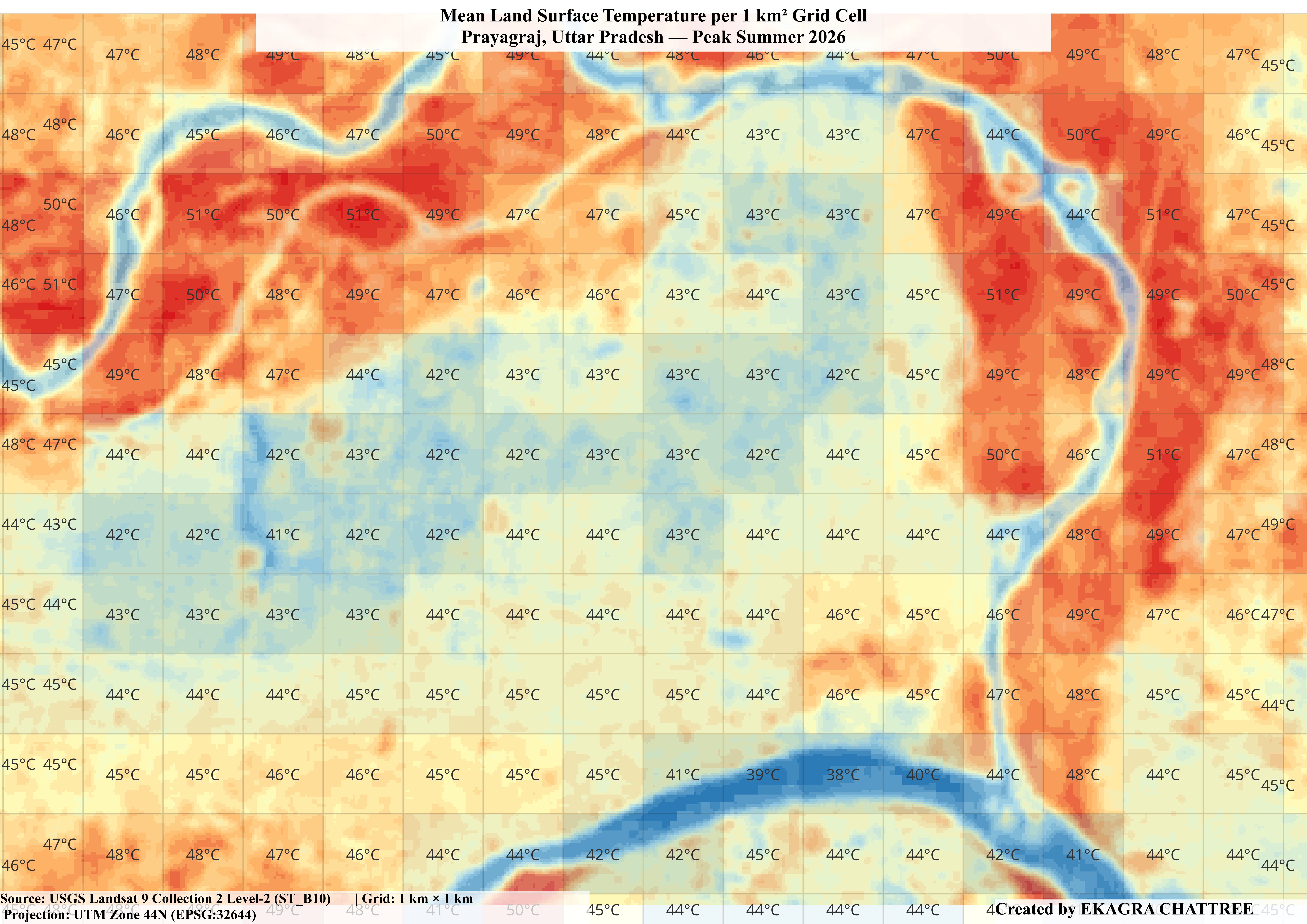
Mapped surface thermal patterns across Prayagraj during the 2026 North Indian heatwave using Landsat 9 LST and Sentinel-2 NDVI. Identified a 6-9°C thermal advantage in the Cantonment zone and confirmed a significant NDVI-LST correlation (r = -0.386, p < 0.001).

View Project
Groundwater Depletion Study

Groundwater Depletion Study
Indo-Gangetic Plain

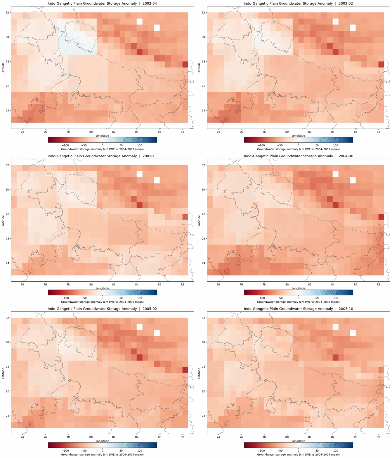
Analysed 24 years of GRACE/GRACE-FO satellite data to map groundwater storage trends across the Indo-Gangetic Plain. Identified a regional depletion rate of -1.82 cm/year, with critical hotspots in the Punjab-Haryana-Western UP belt.

View Project
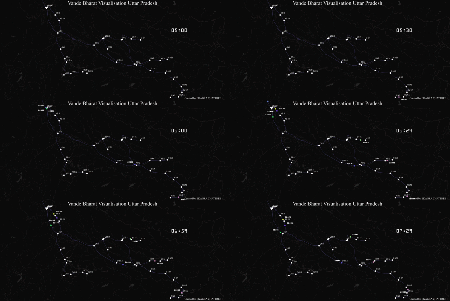
Vande Bharat Transit Visualisation

Transit Visualisation
Vande Bharat Network, UP

Animated the scheduled movement of Vande Bharat Express trains across Uttar Pradesh using railway shapefiles and Indian Railways timetable data. Rendered in QGIS and exported with FFmpeg.

View Project
Prayagraj Metro Accessibility

Pedestrian Accessibility Analysis - Prayagraj Metro

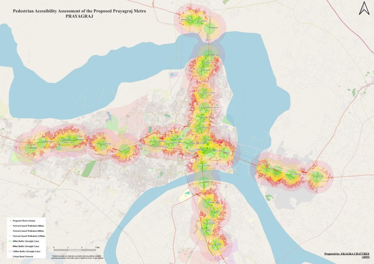
Evaluated pedestrian access to proposed metro stations using road-network walksheds at 400m, 800m, and 1.2km. Built in QGIS using OpenStreetMap data to identify first- and last-mile connectivity gaps.

View Project